
Waiting for the Notch Road to Open
Four visits to a closed gate on a seasonal mountain road, and one visit after it opened. What the wait sounds like, and how little the map has to say about it.
Every autumn a gate swings across a notch road in the middle of the state, and every spring somebody opens it again. Between those two events the road is still there, just not for cars. I watched that gate go across one November, then visited it three times in the spring that followed, to see the season argue with the calendar.
The road is about eleven miles of pavement, gravel, and patched frost damage. It connects two towns that are otherwise an hour apart by the long way around. It climbs through a gap between two ridges, crosses a brook four times, and drops down the far side in turns nobody enjoys in a loaded car. It is not a scenic drive so much as a shortcut with opinions.
Nothing about the closure is dramatic. A metal gate, a sign, a plowed turnaround, and a season of quiet. What interested me was the waiting, and how differently the same locked gate reads in November, March, April, and May.
November 22 and March 8: the gate, closed and buried
The first visit was on November 22, the afternoon two people from the road office swung the gate across and locked it. The whole closing took under two minutes. Behind them the road was bare gravel with ice standing in the ruts, and the brook ran low and clear.
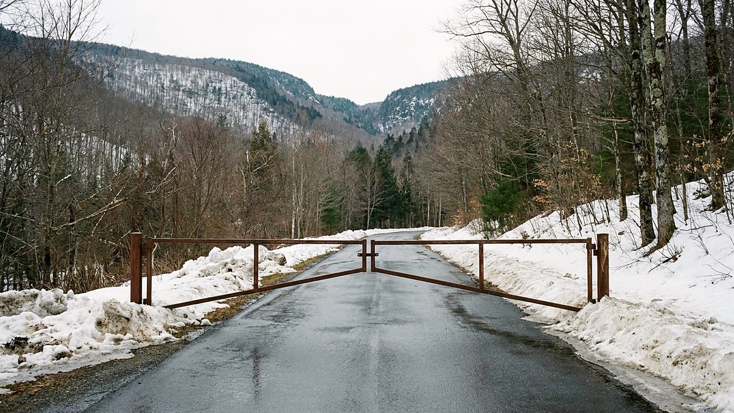
The March visit was cold and bright, with about two feet of settled snow on the road behind the gate. The plow had built a wall across the turnaround, so I parked at the wide shoulder a hundred yards back and walked in. The gate itself had a snowbank against it high enough to make the padlock look ceremonial.
Behind the gate the road was a smooth white lane between dark trees, tracked by snowmobiles and one set of boot prints going in. The surface was firm at ten in the morning and would be soft by one, which is the arithmetic of every March walk here. I went in half a mile and turned around at the first brook crossing.
The brook was mostly under ice, audible but not visible, running somewhere below a curved white shell. I stood there for ten minutes listening to it and decided that was the whole reason for the trip. The temperature was nineteen degrees and the sun was doing nothing useful about it.
On the way out I met a couple on skis who told me the gate usually opens in the second half of May. They said it with the confidence of people who have been wrong about it before.
April 12: water everywhere
April was a different road entirely. Snow had pulled back to patches in the shade, and the roadbed behind the gate had turned into a shallow stream for long stretches. Water came off the slope on the left, crossed the gravel, and went into the ditch on the right in a dozen places.
The brook at the half-mile mark was no longer polite. It was brown, loud, and pushing against the culvert with sticks piling up on the upstream side. I could hear it from the gate, which is roughly eight hundred yards off. Once I got close, the birds were gone under the noise entirely.
The road surface told the story of the winter in plain terms: washouts along the edge, gravel fanned across the pavement in aprons, one section where the shoulder had simply left. This is why the gate stays shut in April even when the snow is gone. It is not closed for weather, it is closed for repair.
I walked a mile and a half in an hour and ten minutes, which is slow. Most of that time went into working around water. My boots failed at minute forty. This surprised nobody, including my boots.
May 3: close, by the sound of it
By the May visit the gate looked almost pointless. The turnaround was dry, the shoulder was firm, and a town truck sat a quarter mile in with two people looking at a culvert. The brook had dropped by a foot and gone from brown to clear, and it sounded like water again rather than like a machine.
I asked one of the crew when the road might open. He said it depended on the culvert, then said late May in a carefully neutral tone, the tone of a man who did not want plans built on his answer. Public notices later put the opening on May 22, which I take as evidence that he knew.
The light in early May does something I had not expected up there. The trees were bare enough to see through, so the shape of the notch showed from the road. It was the first time all spring that the gap read as a gap. Two weeks later the leaves would close that view until October.
May 26: the road as a road
I drove the whole eleven miles four days after the opening. It took thirty-eight minutes, including two stops, and it was the least interesting of the five visits by a wide margin. A road that is open is just a road.
The middle section was freshly graded and generous. The far descent still had frost damage that had not been patched, marked with a single sign and a lot of trust. I passed six vehicles in the whole crossing, four of them pickups.
The brook crossings, which had been the entire event in March and April, went by in a second each. I pulled over at the second one and walked back to listen, because I had come for the sound and not the shortcut. It was ordinary and pleasant and about a tenth as loud as it had been in April.
What the map leaves out
A map shows the road as a continuous line, drawn like any other secondary road. That is a reasonable lie for a map to tell. Nothing on it says the line is only a suggestion from December to May. The seasonal status lives on park pages and town notices, and nowhere else I have found.
The other thing the map cannot show is that this road has two lengths. Eleven miles by car in June, and half a mile on foot in March before the snow softens and sends you home. Both are the correct answer, depending on the month.
Going back
I will do the four gate visits again, because they cost an hour each and pay well. They give a clearer picture of how a season turns than anything I can watch from town. What I will skip is the drive right after the opening. Once the gate is up, the road belongs to people going somewhere, and I am not one of them.
Some plain notes for anyone planning this. The gate turnaround is plowed but not maintained for walking, and it is uneven under the snow. Behind the gate there is no cell signal, no water, and no shelter of any kind. The nearest fuel is a twenty-minute drive back down the valley.
The walk in is flat for the first half mile and then climbs steadily. The surface is ice in March and running water in April, in about equal measure. Anyone who would rather avoid loose gravel and wet feet should wait for June and drive it. There are no restrooms at either end, and the small parking areas fill on fall weekends.
If you want one visit, make it early May, on foot, before the leaves. You get the shape of the notch, a loud brook, and a road that has not yet remembered what it is for. I will be back at that gate in about six weeks, checking the snowbank against last year's notes.
What I checked
- State park pages describing seasonal road closures, gate dates, and winter use of the corridor
- Public notices from state and town road offices on spring opening and posted weight limits
- Municipal pages for the two towns the road connects, including plow and maintenance notes

Asma Tarrant, founder and editor. Filed from Manchester, New Hampshire.